Skip to content
Start My 3 Free Days $0 today · cancel anytime

4th Grade Geography Worksheets

12 4th grade geography worksheets. Teacher favorites: Labeling Latitude and Longitude Worksheet and Latitude and Longitude Worksheet. How teachers use these

4th Grade Geography Worksheets

12 4th grade geography worksheets. Teacher favorites: Labeling Latitude and Longitude Worksheet and Latitude and Longitude Worksheet. How teachers use these

Worksheet
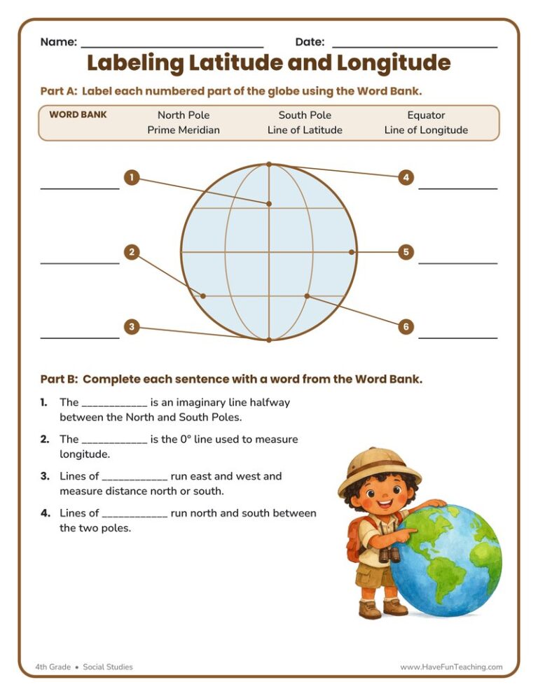
Worksheet4th GradeLabeling Latitude and Longitude Worksheet

This Labeling Latitude and Longitude Worksheet lets 4th graders label a globe’s equator, prime meridian, poles, and grid lines, then explain each one. Answer key included for fast, no-prep geography practice.

Worksheet
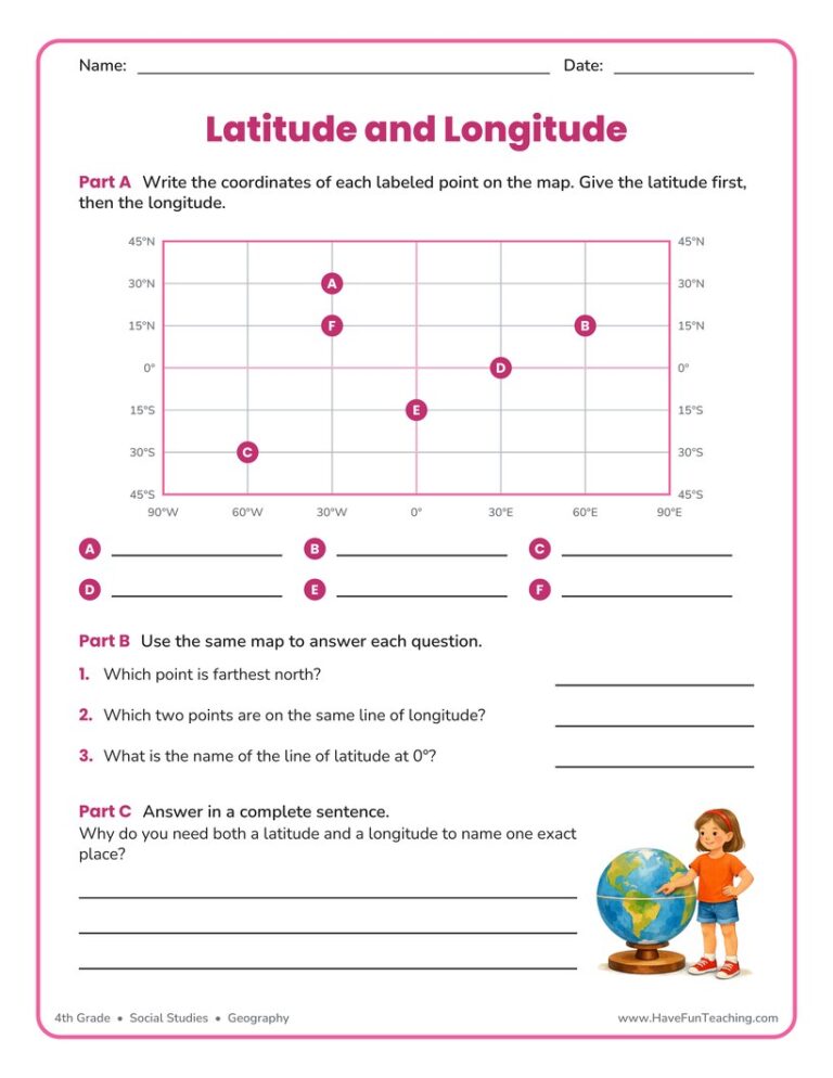
Worksheet4th GradeLatitude and Longitude Worksheet

This latitude and longitude worksheet asks 4th grade students to read six points off a labeled map grid, compare them, and explain why both measurements are needed. An answer key is included for fast checking.

Worksheet
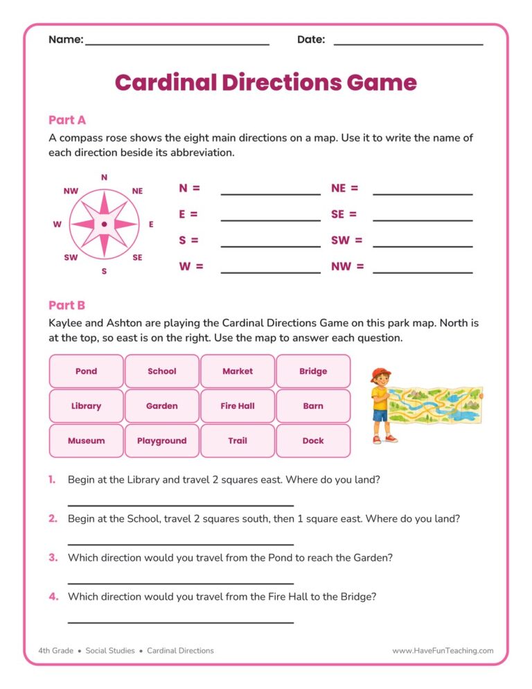
Worksheet4th GradeCardinal Directions Worksheet - Game

This cardinal directions game worksheet asks 4th graders to name all eight compass points, then walk a park map square by square. An answer key is included, so checking map skills takes only a minute.

Worksheet
Worksheet4th GradeLandform Definitions Worksheet

A landform definitions worksheet where 4th graders match six landforms to their meanings, complete clue sentences, and explain their thinking in writing. Answer key included for fast, no-prep geography review.

Worksheet
Worksheet4th GradeCardinal Directions Worksheet

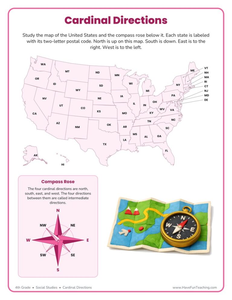
This cardinal directions worksheet gives 4th graders a labeled U.S. map and a compass rose to practice north, south, east, and west. Answer key included for fast, no-prep geography review.

Worksheet
Worksheet4th GradeMap Scales Worksheet

This Map Scales Worksheet gives 4th grade students a trail map with a printed bar scale, four measuring questions, and two written-scale word problems. An answer key is included, so map skills practice is ready to hand out.

Worksheet
Worksheet4th GradeContinents Worksheet - Countries

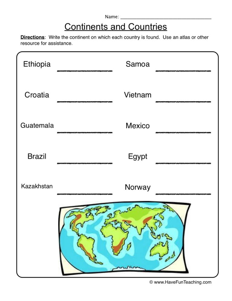
This continents worksheet has 4th Grade students label seven continents on a world map, then name the continent for ten countries. An answer key is included.

Worksheet
Worksheet4th GradeContinents Worksheet - Analyze

This continents map worksheet gives 4th grade students an unlabelled world map with seven numbered markers, five clue questions and a hemisphere question. Answer key included.

Worksheet
Worksheet4th GradeMap Legends Worksheet

This Map Legends Worksheet asks 4th grade students to read a campground map using only its legend and a compass rose, with six questions and a full answer key for quick checking.

Worksheet
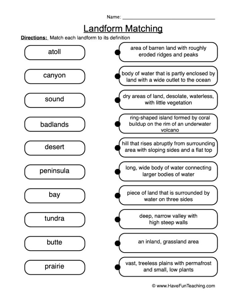
Worksheet4th GradeLandform Matching Definitions Worksheet

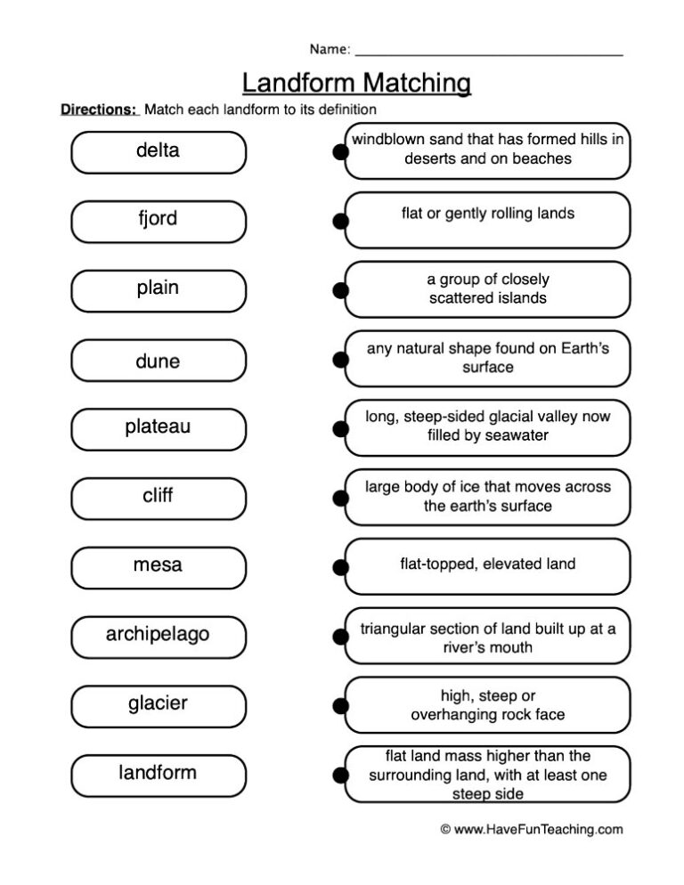
This Landform Matching Definitions Worksheet asks 4th graders to pair six landform words with their meanings, name three pictured landforms, and defend one answer in writing. Answer key included for fast, no-prep geography review.

Worksheet
Worksheet4th GradePirate Map Skills Worksheet

This pirate map skills worksheet sends 4th graders across a treasure island using a compass rose and a bar scale. Four map questions plus two route puzzles, with a full answer key included.

Worksheet
Worksheet4th GradeRiver Systems Worksheet

Use this river systems worksheet to help 4th graders label the parts of a river, match river landforms, and explain their thinking. An answer key is included for quick, easy checking.

From our teachers' playbook

Maps, states and the whole wide world

What do 4th graders learn about geography?

Fourth grade geography turns kids into real map readers. They use cardinal and intermediate directions, read a map legend and scale, and find places with latitude and longitude, like a city at 40°N, 74°W. Many 4th graders study the regions of the United States, learn the 50 states and capitals, and name landforms like plateaus, valleys and deltas. They also look at how geography shapes the way people live, like why cities grow next to rivers. The click is when kids look at a grid and can tell you exactly where in the world something is!

Our favorite ways to teach 4th grade geography

Geography is all about seeing patterns on a map. These moves help kids see them.

Make the grid come alive

Tape a giant latitude and longitude grid on the floor and call out coordinates for kids to stand on. Then move to the paper map and label the lines. Walking the grid first makes "latitude goes across" something they remember with their feet.

Why it works: pairing a picture with each word gives kids two ways to remember it, a well-tested principle of how people learn (Mayer, 2009).

Labeling Latitude and Longitude WorksheetTry it withLabeling Latitude and Longitude WorksheetWorksheetsOpen it →

Sing the states

Play a 50 States song a few times a week and pause it to point to each region on a big map. Kids who sing the states remember them far longer than kids who just read a list.

Why it works: words set to a repeating melody are easier to recall than the same words spoken (Wallace, 1994).

50 States SongTry it with50 States SongSongsOpen it →

Capital quick-fire

Flash a state card and kids call out the capital, then find it on the map. Five cards a day, every day, beats cramming all 50 before the test.

Why it works: a big review of study methods ranked quick self-quizzing among the most powerful ways to remember (Dunlosky and colleagues, 2013).

US States and Capitals Flash CardsTry it withUS States and Capitals Flash CardsFlash CardsOpen it →

Questions parents and teachers ask about 4th grade geography

What geography do 4th graders learn?

Fourth graders learn map skills like directions, legends, scale and latitude and longitude. Many also study U.S. regions, the 50 states and capitals, landforms, and how geography affects the way people live.

How do you explain latitude and longitude to a child?

Latitude lines run across the globe like the rungs of a ladder and tell how far north or south you are. Longitude lines run from pole to pole and tell how far east or west. Where two lines cross is an exact address on Earth.

How can my child memorize the 50 states and capitals?

Learn them by region, a few at a time, and use songs, flash cards and map puzzles. Short daily practice works much better than memorizing all 50 in one sitting.

What is a map scale?

A map scale shows how distance on a map compares to real distance, like 1 inch equals 100 miles. Kids use a ruler and the scale to figure out how far apart two places really are.