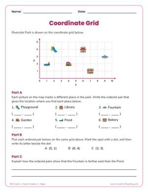
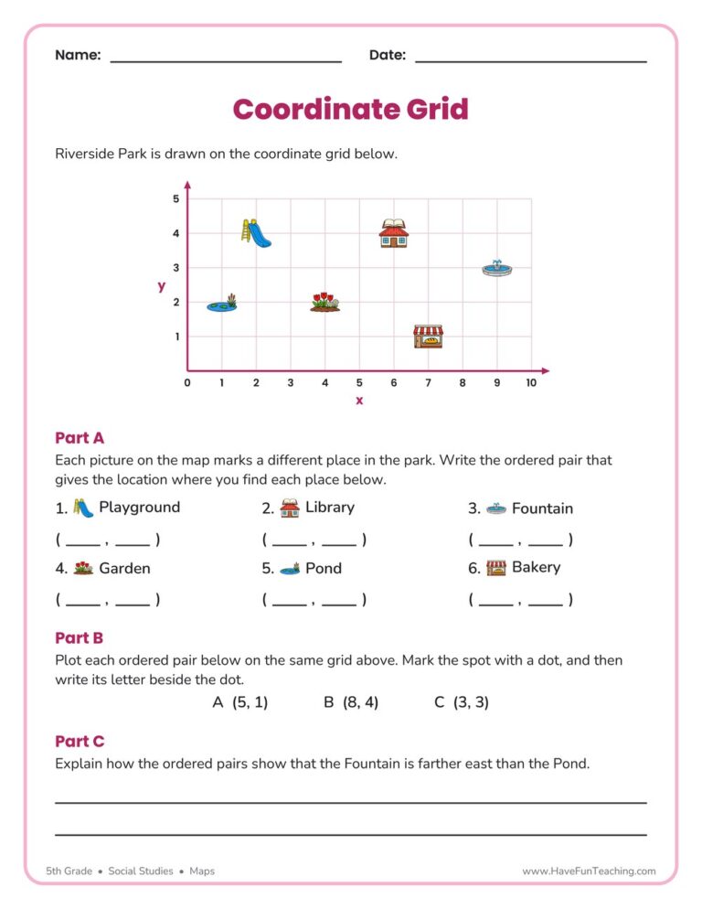
This Coordinate Grid Map Location Worksheet has 5th graders name, plot, and compare places on a park map using ordered pairs. An answer key is included, so grid map skills get real practice with no prep.
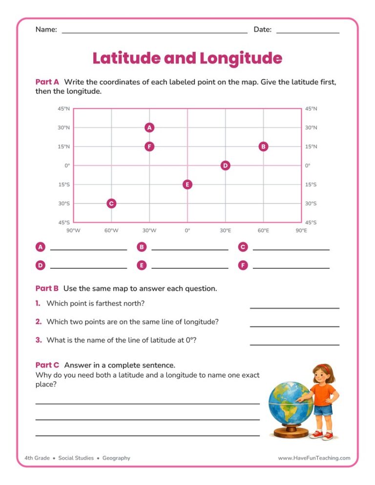
This using latitude and longitude worksheet has 5th grade students read coordinates from a grid map, plot two new points, and explain the Equator. Answer key included for quick checking.
This maps worksheet gives 3rd graders a printed town map with a key and a compass rose, then four reading questions and two route questions. An answer key is included, so map skills practice needs no prep.
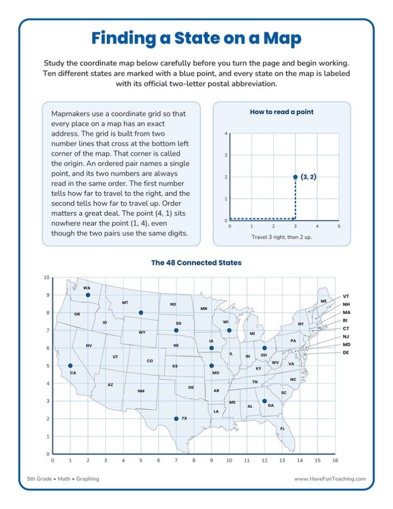
This Finding a State on a Map Worksheet gives 5th grade students a coordinate grid drawn over a United States map, plus a full answer key, so ordered pairs finally point at real places.
Fifth grade maps go way past "north is up." Kids use latitude and longitude to pin down an exact spot, like finding a city near 40°N, 75°W. They read a map scale to figure real distances, compare physical and political maps, and learn why every flat map stretches the round Earth a little. They also locate all 50 states and the big U.S. regions, which ties right into their American history. The click moment is when kids realize the grid lines are just a giant coordinate plane wrapped around the globe.
Our favorite ways to teach map skills
Map skills grow fastest when kids actually use maps to answer questions. These are the moves we count on.
Think aloud a coordinate hunt
Put a world map up and think out loud: "First I find the equator for latitude, then the prime meridian for longitude, then I slide my fingers until they meet." Do the next location together, then let partners try one alone. Modeling the order of steps stops the classic mix-up of reading longitude first.
Why it works: handing over the work step by step, from teacher to student, is one of the most widely used teaching frameworks (Pearson and Gallagher, 1983).
Give three quick clues: "I border Canada. I have a lot of lakes. My neighbor is Wisconsin." Kids find and name the state on their map. A one-minute daily quiz like this builds state knowledge much faster than coloring a whole U.S. map once.
Why it works: a big review of study methods ranked quick self-quizzing among the most powerful ways to remember (Dunlosky and colleagues, 2013).
Fifty state names are a lot to hold. A song gives them a rhythm kids can hum while they point to each state on a map. Play it while kids trace the regions, and soon they'll be singing it in the hallway.
Why it works: a catchy, repeating tune gives the brain a hook to hang words on, so sung text is remembered better (Wallace, 1994).
Questions parents and teachers ask about 5th grade maps
What map skills should a 5th grader have?
A 5th grader should read latitude and longitude, use a map scale to find distance, follow cardinal and intermediate directions and read a map key. Most 5th graders also learn to locate the 50 states and the major U.S. regions.
How do I teach latitude and longitude?
Start with a simple grid, then show that latitude lines run east and west and measure north or south of the equator. Longitude lines run north to south and measure east or west of the prime meridian. Always say latitude first.
What is the difference between a physical and a political map?
A physical map shows natural features like mountains, rivers and deserts. A political map shows borders, states, countries and cities that people created.
How can kids practice map skills at home?
Hand them the map on a trip and let them navigate. Ask, "Which direction are we heading? How far is it to the next city?" Real use beats any worksheet.
Written by the Have Fun Teaching team of elementary teachers and homeschoolers. Research: Pearson, P. D., & Gallagher, M. C. (1983). The instruction of reading comprehension. Contemporary Educational Psychology, 8(3). Dunlosky, J., Rawson, K. A., Marsh, E. J., Nathan, M. J., & Willingham, D. T. (2013). Improving Students' Learning With Effective Learning Techniques. Psychological Science in the Public Interest, 14(1). Wallace, W. T. (1994). Memory for music: Effect of melody on recall of text. Journal of Experimental Psychology: Learning, Memory, and Cognition, 20(6).
3 days free
2:39Ready to print!
Printables · Songs · Games
Loved by 2 million teachers & families
Where learning feels like play.
Printables, songs and games for every subject, Preschool through 6th. Ready to teach today, and kids beg for more.
$0due today
then $39.97$35.97for your first year, and $39.97 a year after that.



 Try it withUsing Latitude and Longitude WorksheetWorksheetsOpen it →